http://www.youtube.com/watch?v=YTFzqAhbyMU
Sent from my iPod
Friday, September 16, 2011
Tuesday, September 13, 2011
A few videos if you're so inclined.
One of the black bears we saw heading into Hyder, AK:
http://www.youtube.com/watch?v=j8G2BlVjePE&feature=related
The road south of Anchorage (every local we spoke to said this was one of the deadliest roads in AK; due to tourists pulling over to take pics.) And now, here's whitley taking a video:
http://www.youtube.com/watch?v=yeKVaTvZunY&feature=related
The gang on the Alaska Hwy:
http://www.youtube.com/watch?v=sqtbRtLSRXc
Sampling of the Alaska Hwy construction:
http://www.youtube.com/watch?v=_JDSWzSTc1Y
Problems on the Alaska Hwy? Don't worry, I'm sure DB will stop to help:
http://www.youtube.com/watch?v=Sidce3pH_DA
Appreciate it.
Monday, September 12, 2011


Sunday, September 4, 2011
Day 16. The road home.
Denver to Amarillo (420 miles),
Denver to Prosper (775),
Denver to San Antonio (920).
The three paths home saturday. All three bikes made it back safely.
I arrived back in SA about 10:30pm saturday, 16 days after leaving. Total mileage, according to my gps: 9,306.
Just a great trip. More thoughts to come.
My thanks to DB and Whitley, great time.

Friday, September 2, 2011


Bozeman, MT to Denver, CO 680 miles
Foiled by t-storms and holiday traffic in Denver, didn't make Limon. Staying near the Denver airport. Had our first 90 degree day since day 1. Bozeman was 37 when we left this morning, 94 across central Wyoming. I don't think we're going to handle 100+ well tomorrow.
Hopefully home tomorrow night.
Hopefully home tomorrow night.

Thursday, September 1, 2011
Day 14: to Bozeman, MT


Not a lot of witty comments about today. Just hours of the above.
Spokane BMW dealership all morning and I-90 (with construction) all afternoon. This blog probably won't improve much over the next few days. Stay tuned for more interstate shots.
Tomorrow the goal is Limon, CO.
Wednesday, August 31, 2011


Tuesday, August 30, 2011
Day 12: to Quesnel, BC
Hyder to Quesnel, BC
Once you leave Hyder everyone begins to drop subtle comments like: "you know, we could be home in four days", followed by light laughter; then everyone gets real quiet, and in the awkward silence its decided, the sight-seeing portion of this trip is over. It has officially become get home by any means necessary and as fast as possible.
We tried to get to Williams lake in British Columbia tonight but both of db's headlights have gone out (along with whitley's main lamp). So we stopped in Quesnel at dark. On to Spokane tomorrow to the BMW shop for new bulbs.
Aug29-1-bear glacier
Check out this video on YouTube:
http://www.youtube.com/watch?v=RZzGIzEY5nc&feature=youtube_gdata_player
Bear glacier coming into Hyder.


Monday, August 29, 2011


End of day 11: to Hyder, AK
Nothing like the final 40 miles into Hyder to lift your spirits. Next to homer, it may be the best motorcycle road in north america. The glaciers come right down to the road, which follows a river that empties into a pacific inlet in Hyder. We saw 10 black bears during the drive in. And we got the last room at the grandview inn. All in all a good end to the day.
We took the cassiar hwy from Watson lake to Hyder. It is completely paved now and in great shape. Whitley took some pics that will follow.
We took the cassiar hwy from Watson lake to Hyder. It is completely paved now and in great shape. Whitley took some pics that will follow.

Mid day 11
I would like to congratulate august 29,2011 and the 162 miles from Teslin to Watson lake for cracking the top three in the "Coldest I've Ever Been" category. The rain from yesterday has continued thru today. The temperature never rose above 38 until Watson lake, which lead to this exchange at the gas station three hrs into today's ride:
Me (while trying to extract my hand from my dripping, soaked-through leather glove): "I can't feel my hands."
Whitley (whistling as he removed his water proof, electrically heated gloves): "godamighty, what'd ya think, we were riding down to el campo or something!"
Me: "thanks."
Trying to get to hyder, but Db forgot his rain gear at the motel in Teslin and it's still 45 and raining, may be a short day. We' re in dease lake now.
Big thank you to motohank for assisting us with our water-in-db's-gas-tank-problem in Watson lake. Everything is running fine now. (db isn't having a good day.)


Sunday, August 28, 2011
Day 10: to Teslin, YT
Dawson, YT to Teslin, YT 440 miles
Our run of good fortune with the weather came to an end today. It was 35 and clear leaving Dawson. but the rain got us 100 miles from whitehorse. it was in the mid 40s with heavy rain all afternoon. finally gave up on making it to watson lake about 140 miles short in teslin at the yukon motel.
At this place (again):


Day 9: to Dawson, YT
Glennallen,ak to Dawson, Yt. 310 miles.
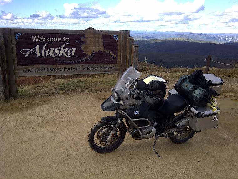
We returned to Tok then headed north on the Taylor hwy to Chicken, Ak. Just before chicken the pavement ends and continues on for 100 miles as a dirt/gravel/unpaved road to the Yukon river and Dawson as the Top of the World Hwy. Chicken was a cool little town except for the fact that they have started to bus traveling senior citizen groups there from Dawson. Ruined. You feel like you're in the middle of no where (and you are) and then a giant tour bus pulls up and 50 grandmothers step out taking pictures. We didn't stay long.
We got lucky on the weather, not a cloud in the sky.
The Top of the world hwy dead-ends into the Yukon river and you take a barge across to Dawson. Dawson is exactly as it was 150 years ago. Old gold mining town. This was the farthest north we were on the entire trip. From Dawson It's 230 miles to the artic circle via the Dempster hwy. we didn't have the days to go up and back--next time.
Tomorrow to Watson lake.
Friday, August 26, 2011

Subscribe to:
Posts (Atom)